 |
|
|||||||||||||||||||||||||||||||||||||||||||||||||||||||||||||||||||||||||||||||||||||||||||||||||||||||||||||||||||||||||||||||||||||||||||||||||||||||||||||||||||||||||||||||||||||||||||||||||||||||||||||||||||||||||||||||||||||||||||||||||||||||||||||||||||||||||||||||||||||||||||||||||||||||||||||||||||||||||||||||||||||||||||||||||||||||||||||||||||||||||||||||||||||||||||||||||||||||||||||||||||||||||||||||||||||||||||||||||||||||||||||||||||||||||||||||||||||||||||||||||||||||||||||||||||||||||||||||||||||||||||||||||||||||||||
|
|
|
|
|
|
|
|
||||||||||||||||||||||||||||||||||||||||||||||||||||||||||||||||||||||||||||||||||||||||||||||||||||||||||||||||||||||||||||||||||||||||||||||||||||||||||||||||||||||||||||||||||||||||||||||||||||||||||||||||||||||||||||||||||||||||||||||||||||||||||||||||||||||||||||||||||||||||||||||||||||||||||||||||||||||||||||||||||||||||||||||||||||||||||||||||||||||||||||||||||||||||||||||||||||||||||||||||||||||||||||||||||||||||||||||||||||||||||||||||||||||||||||||||||||||||||||||||||||||||||||||||||||||||||||||||||||||||||||||||||||||
 |
 |
|
||||||||||||||||||||||||||||||||||||||||||||||||||||||||||||||||||||||||||||||||||||||||||||||||||||||||||||||||||||||||||||||||||||||||||||||||||||||||||||||||||||||||||||||||||||||||||||||||||||||||||||||||||||||||||||||||||||||||||||||||||||||||||||||||||||||||||||||||||||||||||||||||||||||||||||||||||||||||||||||||||||||||||||||||||||||||||||||||||||||||||||||||||||||||||||||||||||||||||||||||||||||||||||||||||||||||||||||||||||||||||||||||||||||||||||||||||||||||||||||||||||||||||||||||||||||||||||||||||||||||||||||||||||||||||
|
|
|
|||||||||||||||||||||||||||||||||||||||||||||||||||||||||||||||||||||||||||||||||||||||||||||||||||||||||||||||||||||||||||||||||||||||||||||||||||||||||||||||||||||||||||||||||||||||||||||||||||||||||||||||||||||||||||||||||||||||||||||||||||||||||||||||||||||||||||||||||||||||||||||||||||||||||||||||||||||||||||||||||||||||||||||||||||||||||||||||||||||||||||||||||||||||||||||||||||||||||||||||||||||||||||||||||||||||||||||||||||||||||||||||||||||||||||||||||||||||||||||||||||||||||||||||||||||||||||||||||||||||||||||||||||||||||||
|
|
|
|
||||||||||||||||||||||||||||||||||||||||||||||||||||||||||||||||||||||||||||||||||||||||||||||||||||||||||||||||||||||||||||||||||||||||||||||||||||||||||||||||||||||||||||||||||||||||||||||||||||||||||||||||||||||||||||||||||||||||||||||||||||||||||||||||||||||||||||||||||||||||||||||||||||||||||||||||||||||||||||||||||||||||||||||||||||||||||||||||||||||||||||||||||||||||||||||||||||||||||||||||||||||||||||||||||||||||||||||||||||||||||||||||||||||||||||||||||||||||||||||||||||||||||||||||||||||||||||||||||||||||||||||||||||||||||
|
EXECUTIVE SUMMARY S.1 INTRODUCTION The Federal Highway Administration, Central Federal Lands Highway Division (FHWA), in cooperation with the State of Hawai'i Department of Transportation (HDOT) is proposing to improve Saddle Road, State Route 200 (SR 200). The U.S. Department of the Army (DOA), Military Traffic Management Command (MTMC), serves with the FHWA as co-administrator of the Defense Access Road (DAR) Program. FHWA is the lead agency for environmental compliance. This Environmental Impact Statement (EIS) has been prepared to evaluate the proposed action in accordance with the National Environmental Policy Act of 1969 as amended (NEPA) and Chapter 343 of Hawai'i Revised Statutes (HRS) related to Environmental Impact Statements. The proposal would upgrade and modernize Saddle Road as a two-lane highway that would meet AASHTO design standards for rural arterials and provide adequate capacity to handle anticipated traffic volumes through 2014 and beyond. The portion of Saddle Road to be improved by this project is approximately 78 kilometers (km) in length and extends from the Mamalahoa Highway (SR 190) to Milepost (MP) 6, near Hilo, Hawai'i (Figure 2.2.1, Overview of Segments Under Consideration). The Saddle Road project is included in the Island of Hawai'i Long Range Land Transportation Plan as a Tier 1 Project and will be placed in the federally-required State Transportation Improvement Program (STIP). The MTMC has determined that the design and construction of the Saddle Road improvements within the approximate limits of the Pohakuloa Training Area (PTA) would be eligible for DAR funds. Funds for constructing the DAR section of highway must be authorized and appropriated by Congress. HDOT will improve the remaining portion of the road, as funds become available. Existing Saddle Road is approximately 85 km in length extending west from Hilo to its junction with the Mamalahoa Highway (SR 190), approximately 10 km south of Waimea, on the Island of Hawai'i. It was constructed in 1942 by DOA. Saddle Road is a narrow, winding, two-lane road with steep grades, sharp curves, poor pavement, and substandard drainage. It does not meet contemporary design standards. Saddle Road is the only paved road serving the astronomical observatory complex on Mauna Kea, Waiki'i Ranch, upper Kaumana, Mauna Kea State Recreation Area, Kilohana Girl Scout Camp, and major hunting areas. Saddle Road is also an important cross-island link for business travel, the transport of goods and services, tourism, recreation, shopping, and commuting. Saddle Road is the only paved arterial serving the PTA. PTA provides unique training opportunities to the 25th Infantry Division (Light) and units of other services supported by U.S. Army, Hawai'i. These unique opportunities include live-fire maneuver training by larger size infantry units than can be accommodated on Oahu, the ability to fire certain weapons systems at their maximum range, and the ability to train and certify aviation units. PTA plays an important role in complementing other Army live-fire training ranges on the Island of Oahu. Transportation of ammunition, water, training equipment, and troops from harbors on both sides of the island creates long, slow-moving convoys on Saddle Road. Saddle Road is also used by PTA personnel to commute to work. S.2 PURPOSE AND NEED The purpose of this project is to provide a safe and efficient route for access along Saddle Road and for cross-island traffic between East and West Hawai'i. The proposed improvements to Saddle Road would address five general types of needs: roadway deficiencies, conflicts with and hazards of military operations, capacity, safety, and social demand and economic development.
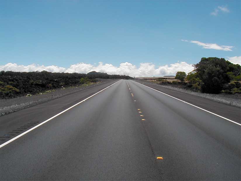
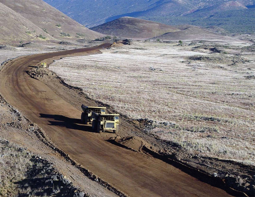
S.2.1 Roadway Deficiencies Although Saddle Road is presently two-directional, in practicality, deterioration of the pavement has reduced much of the road to one asphalt travel lane, roughly 4 meters (m) in width, with shoulders less than 1 m in width. Shoulder pavement is more patchy than continuous and shoulder areas do not have adequate "clear zone" or recovery areas. The narrow width and poor pavement conditions encourage motorists to drive in the center of the road, increasing the potential for accidents, including head-on collisions. One stretch of Saddle Road contains six one-lane bridges. Saddle Road is characterized by steep grades and sharp curves with horizontal and vertical alignment deficiencies, which in many places prevent motorists from being able to see ahead a safe distance to pass or stop. Under these conditions, passing slow-moving vehicles is very hazardous. In addition, pavement markings and roadway signage over much of the road are currently inadequate. Drainage structures are undersized and Saddle Road is often closed during major storm events because of flooding and hazardous road conditions. S.2.2 Conflicts/Hazards with Military Operations Saddle Road crosses through the northern portion of the PTA. Extensive training along and across the road has created conflicts between the traveling public and military training exercises, and has reduced the quality of many training maneuvers. Some military operations require artillery to fire over Saddle Road. Training operations by infantry require troops to break from "tactical" formations to "administrative" formations to move across the road. With little warning, motorists may encounter soldiers or military equipment crossing the road. S.2.3 Capacity The 1994 average daily traffic (ADT) on Saddle Road was 900 vehicles. Without the project, Saddle Road ADT is projected to be 4,400 by 2014. This level of need far exceeds the road's existing traffic capacity. With the proposed improvements, Saddle Road ADT is expected to increase to 14,000 by 2014, nearly a four-fold increase over that of the No Action Alternative. The projected increase is because of a variety of demands: increased usage associated with commuter traffic; residential development at both ends of the road; tourism and recreation; agriculture; military operations; the Mauna Kea telescope complex; and increasing congestion along alternative cross-island routes. Level of Service (LOS) expresses quality of traffic flow. It relates to the density of traffic in comparison to the roadway's capacity and expresses conditions of speed, travel time, freedom to maneuver, traffic interruptions, comfort, convenience, and safety. The quality of traffic flow is described in six categories of service, A through F, with LOS A representing traffic in a free flow or uncongested condition, and LOS F representing serious congestion and considerable delays (Table S.1, Current and Future Traffic Volumes and LOS). On a two-lane road, such as Saddle Road, LOS is primarily determined by the ability to pass. Using operational analysis procedures presented in the Highway Capacity Manual, Third Edition, 1994, the LOS under current conditions was calculated. Based on these procedures, Saddle Road is operating at LOS B in some segments, and LOS D in most areas (Table S.1). Given the poor condition of the pavement, its narrow width, alignment deficiencies, and poor sight distances, LOS B overstates the road's current level of service. The FHWA has concluded that the overall LOS for Saddle Road is D. In this instance, LOS D reflects that passing demand is high while passing capacity is very low. With projected traffic growth and no road improvements, Saddle Road is expected to deteriorate to LOS E by 2014. With LOS E, passing in most locations would be unsafe and platooning (slow-moving vehicle causes the backup of vehicles unable to pass) would occur. With the proposed improvements, the road's current LOS D would be improved to LOS B along W-3, PTA-1, and most of EX-3 by the design year 2014. Roughly the lower 8.1 km of EX-3 and the E-3 alignment would operate at LOS C much of the time, with short segments at LOS D during peak hours in the design year (ref: Figure 2.2.1, Segments Under Consideration). This lower LOS on part of recommended alignments is primarily a result of a more curvilinear alignment with reduced passing opportunities on steeper grades. The curvilinear alignment and reduced passing opportunities are the result of efforts to minimize impacts on sensitive environmental resources in this area. LOS C is acceptable for a design standard when there are overriding factors such as cost and impacts.
S.2.4 Safety Roadway deficiencies, conflicts with military operations, and capacity limitations contribute to safety concerns on Saddle Road. Saddle Road's accident rate of 5.43 accidents per million vehicle miles (ACC/MVM) is notably higher than the average rate for rural two-lane highways throughout the State of Hawai'i (3.0 ACC/MVM). Roadway deficiencies also hinder the response of emergency vehicles responding to fires, accidents, and other incidents along Saddle Road. S.2.5 Social Demand and Economic Development East and West Hawai'i are distinct in economic opportunities and development. Without an efficient, safe, cross-island route, business opportunities across the island are more limited, and the economies of East and West Hawai'i would be expected to continue to diverge. Government functions are located on the east side of the island in Hilo, where housing costs are generally lower, while much of the tourism-related economic growth and employment is occurring in West Hawai'i. In addition, these conditions create a need for some people to commute cross-island. Decreased cross-island travel times would increase labor force mobility. SR 19 along the Hamakua Coast is considered the most feasible alternative to Saddle Road for cross-island transportation. SR 19 is longer than Saddle Road between Hilo and Kailua-Kona, and Hilo and Waikoloa. Between Hilo and Waimea, SR 19 is the shorter route. Because of the deficiencies of Saddle Road, the lack of services and few roadside amenities, SR 19 currently carries a larger percentage of the cross-island traffic, resulting in congestion on SR 19 during peak travel hours and increased travel time. S.3 ALTERNATIVES Over a three-year period, 1994 to 1997, alternatives for improvement of Saddle Road were developed and refined with the input and involvement of a Social, Economic, and Environmental Team (SEE Team), the Saddle Road Community Task Force (SRTF, a volunteer citizen's group), government agencies, local residents, landowners, and citizens-at-large through agency and public scoping meetings, the distribution of a DEIS, and public hearings. The SEE Team is an interagency project coordination and guidance team established by FHWA at the outset of all projects and, in this instance, consisted of HDOT, Hawai'i County, U.S. Army Corps of Engineers (USACE), U.S. Army [U.S. Army Pacific Command (USARPAC), U.S. Army Garrison, Hawai'i (USAG-HI), and MTMC], USFWS, Environmental Protection Agency (EPA), and FHWA. This process allowed for early consideration of engineering and environmental issues and numerous refinements of the alternatives under consideration. Of the alternatives considered, some were determined to warrant further analysis, while some were initially considered but eliminated. A No Action Alternative was also considered and evaluated. A Preferred Alternative was not presented in the DEIS. Documenting the final results of this process, an FHWA Recommended Alternative was ultimately selected. The selection of this Recommended Alternative was made with full consideration of the potential impacts of the project and the review of public and agency comments. A legally binding Record of Decision (ROD) will be prepared for this Recommended Alternative. S.3.1 Design Parameters Common to All Action Alternatives Saddle Road is to be developed to rural arterial design standards, incorporating design controls presented in the following table. Uphill passing lanes, truck escape ramps, scenic pullouts, and military vehicle crossings will be incorporated into project designs as needed to enhance safety and improve the projected level of service. Table S.2, Design Criteria, provides a summary of the design features of the proposed project.
Design speed may be increased up to 100 km per hour in areas where feasible The proposed improvements to Saddle Road would incorporate two 3.6-m travel lanes with two 2.4-m paved shoulders. Passing lanes or pullouts will be added in selected locations. In environmentally vulnerable portions of the study corridor within the PTA, additional features would be constructed to minimize fire hazards, including paved fire breaks, fencing, and asphalt curbs. S.3.2 Action Alternatives Identified and Considered The project area has been divided into four sections. Section I begins on the west end at the junction with Mamalahoa Highway (SR 190) and extends east to Saddle Road MP 42. Section II extends from MP 42 to MP 28. Section III extends from MP 28 to MP 9, and Section IV extends from MP 9 to the eastern project terminus, MP 6 (ref: Figure 2.2.1). A total of 20 segments within the aforementioned sections were initially considered (ref: Figure 2.3.1). Of these, 12 segments were eliminated from further consideration at various points of the study process by consensus of the SEE Team. These alternatives were eliminated because they failed to meet the criteria developed in the purpose and need (e.g., road deficiencies, capacity) or because it was evident without further detailed analysis that the anticipated impacts of their construction were clearly greater than other alternatives. The remaining eight segments were considered feasible, warranting further analysis: W-2 and W-3 in Section I; PTA-1, PTA-3, and EX-2 in Section II; EX-3 in Section III; and EX-4A and E-3 in Section IV. In addition, the No Action Alternative is also considered. Section I. Segments W-2 and W-3 represent alternative routes to the existing Saddle Road alignment within Section I. Located south of the existing alignment, W-2 would connect Saddle Road to Mamalahoa Highway (SR 190) at Waikoloa Road, Segment W-3 would connect with Mamalahoa Highway (SR 190), 4.8 km south of Waikoloa Rd. Section II. Segment EX-2 consists of the complete reconstruction of Saddle Road to bring it up to American Association of State Highway and Transportation Officials (AASHTO) standards. This segment would be reconstructed along the existing Saddle Road corridor. It would not accomplish the desired separation of motorists from military maneuvers. Segments PTA-1 and PTA-3 represent alternative routes to the existing Saddle Road alignment within Section II. Located north of the existing roadway, PTA-1 and PTA-3 would succeed in separating Saddle Road motorists from military maneuvers. Section III. Segment EX-3 consists of the complete reconstruction of Saddle Road to meet AASHTO standards. This segment would be reconstructed along the existing Saddle Road corridor. No feasible or practicable alternatives to the existing corridor were identified within Section III. Section IV. Segment EX-4A consists of the complete reconstruction of Saddle Road to meet AASHTO standards. This segment would be reconstructed along the existing Saddle Road corridor on the west and east ends of Section IV, but would split from the existing roadway for a 2-km portion in the middle to follow an existing transmission line corridor. Segment E-3 represents an alternate alignment to EX-4A through Section IV and relocates the road south of the existing Saddle Road and farther away from the residential areas in upper Kaumana. Table S.3, Comparison of Segments, provides a summary of the key engineering characteristics and costs of each segment.
1 1999 dollars 2 Exception to standard in one location less than 500 m in length. * Designates Recommended Alternative Segments. S.3.3 No Action Alternative The No Action Alternative would maintain Saddle Road as it is today. It would include existing maintenance efforts with some possible surface rehabilitation activities. It would not enhance safety, eliminate roadway deficiencies, improve level of service, improve operational function, accommodate future traffic levels, nor reduce or eliminate conflicts between motorists and PTA military operations. S.3.4 Selection of FHWA-Recommended Alternative Following the issuance of the Saddle Road Draft EIS (DEIS), the public hearing, and the close of the public comment period, and in consideration of the scientific and technical information developed for the project, as well as public input received, the SEE Team identified Segment W-3 (Section I), PTA-1 (Section II), EX-3 (Section III), and E-3 (Section IV) as their recommendation to the FHWA for improving Saddle Road. The FHWA has adopted these four segments as their Recommended Alternative (ref: Figure 2.2.1). The following text summarizes the primary reasons for the selection of these four segments. The No Action Alternative was not selected because it would not satisfy the project's purpose and need. One of the most notable considerations in the selection of W-3 as the Recommended Alternative was its efficiency for serving cross-island traffic because the largest percentage of motorists using Saddle Road are coming from or going to Kona. In terms of overall time and fuel savings, W-3 would result in greater benefits to Saddle Road motorists and the community as a whole. Based on the information available on terrain and geology, and the shorter length of W-3 over W-2, the FHWA determined that W-3 would prove less costly to build than W-2, if detailed design cost estimates were conducted. In addition, traffic operations would be more efficient on W-3 because of less steep grades. The FHWA also considered public opinion. With the proximity of W-2 to Waiki'i Ranch, community members expressed concern that the siting of Saddle Road on the W-2 alignment would result in noise pollution and would impact the commercial viability of their properties. In consideration of community benefits, construction cost savings, and other reasons noted, W-3 was selected as the recommended alternative for Section I. The abandoned existing Saddle Road serving Waiki'i and other local access needs would become the responsibility of Hawai'i County to maintain. A modern intersection connecting the existing road to W-3 would be provided at MP 42. Section II The most notable consideration in the selection of PTA-1 is that EX-2 would not completely satisfy the project purpose and need because no improvement in the quality and safety of military training would be anticipated and existing conflicts between the military and the public would be only partially removed. In contrast, either PTA-1 or PTA-3 would completely satisfy the project purpose and need. Both of these alignments would also result in substantial impacts by direct modification of Palila Critical Habitat. However, as stated by the U.S. Fish and Wildlife Service (USFWS) in the Final BO, the mitigation measures built into the project design will offset the modifications being made to Palila Critical Habitat and enhance the likelihood of survival and recovery of the Palila. Palila is the lone surviving Finch-billed Honeycreeper found on Hawai'i. The most notable differences between PTA-1 and PTA-3 is that PTA-1 is shorter, provides a more direct alignment, would be less costly, and would impact less Palila Critical Habitat. In consideration of the mitigation measures developed for the Palila and the other reasons stated, PTA-1 was selected as the recommended alternative for Section II. Ownership of the existing Saddle Road in this Section would be transferred to the military as required. Section III As a result of much discussion and investigation of potential alternative routes through Section III, it was concluded that all routes other than EX-3 would provide notably greater impacts to adjacent resources. Segment EX-3 was selected as the recommended alternative for Section III. Section IV While E-3 would result in the fill of more wetland resources, much of this wetland area is in degraded habitat. In consideration of the native habitat disturbed, the impacts to biological resources were determined to be roughly equivalent for E-3 and EX-4A. EX-4A would cut through the community of Kaumana and would require the acquisition of residential property and the relocation of 11 to 28 households. It would approach or exceed the national noise abatement criteria at 29 residences, and would cause a substantial increase in noise at 18 additional ones. In addition, when considering initial construction and long-term motorist operating costs, EX4A would be the more costly segment over the life of the project. The FHWA also considered public opinion. Letters from Kaumana residents and the Kaumana City Association expressed support for the selection of E-3 and opposition to EX-4A. For these reasons, E-3 was selected as the recommended alternative for Section IV.
S.3.5 Least Environmentally Damaging Practicable Alternative, Sections III and IV In Sections III and IV, the fill of jurisdictional wetlands will be required for the construction of proposed Saddle Road improvements. To determine the Least Environmentally Damaging Practicable Alternative (LEDPA), to address concerns and requirements of the EPA, the USFWS, and the USACE, and to provide a wetland mitigation proposal, a 404(b)(1) Analysis Report was prepared for this project. The 404(b)(1) Analysis Report was prepared in accordance with the "Guidance Papers to Facilitate the Implementation of the Memorandum of Understanding for the NEPA and Section 404 Integration Process for Surface Transportation Projects in Hawai'i" (June, 1994) and the 40 CFR Part 230 Section 404(b)(1) Guidelines for Specifications of Disposal Sites for Dredged or Fill Material. The results of this analysis identified Segment EX-3 as the LEDPA within Section III and E-3 as the LEDPA within Section IV. S.4 PROJECT DEVELOPMENT AND PUBLIC INVOLVEMENT The following paragraphs briefly summarize the key components of the project's development, emphasizing those actions related to the agency and public involvement process. The input received during this process was voluminous and extremely varied in content regarding issues and concerns. For this reason, the reader is referred to Part II of the FEIS for additional, more detailed information. To incorporate input from participating agencies throughout the project development process, a Social, Economic, and Environmental Team (SEE Team) was established in 1990. The SEE Team is comprised of representatives from each participating agency (ref: FEIS - Part II, 1.2.2). A series of SEE Team meetings were held from January 1990 to March 1998 (ref: FEIS - Part II, 1.1). In May 1993, various citizens of the County of Hawai'i were invited by Senator Inouye to form a task force for the project. The Saddle Road Community Task Force (SRTF) was formed to solicit and disseminate information about the project within the community (ref: FEIS - Part II, 1.2.1). A series of SRTF meetings were held from June 1993 to July 1999. From January 1994 to the present, numerous one-on-one meetings were held upon request with interested individuals, agency representatives, and public and private organizations to provide project briefings and/or receive input on project issues and concerns. These included groups such as community councils, community associations, chambers of commerce, and clubs. A Letter of Intent was sent to all interested parties, agencies, and organizations, and a Notice of Intent was published in the Federal Register, March 1994 (ref: FEIS - Part II, 1.4.1). Notifications of public scoping meetings were mailed in April 1994 (ref: FEIS, Part II, 1.4.1) and Public Scoping Meetings were held in Hilo (May 10), Kona (May 11), and Waimea (May 12). An Interagency Scoping Meeting was held in Hilo (May 10). In July 1994, project information centers were maintained in Hilo and Kona for several months to make project information available to interested persons and to receive comments. Notices of these centers were published in Hilo and Kona newspapers.
Newsletters were prepared and distributed to a mailing list of over 1,500 people. The first was published in November 1994. To report on the progress of the project, four additional newsletters were subsequently published and distributed, from November 1996 through August 1999 (ref: FEIS - Part II, 1.5). In October 1995, pursuant to State law, an Environmental Assessment and Notice of Preparation of an EIS was submitted to the State of Hawai'i Office of Environmental Quality Control (ref: FEIS, Part II, 1.4.2). This notice was published in their environmental bulletin which is monitored regularly by interested agencies, organizations, and the public. In May 1996, sixteen invitations were extended for Cooperating Agency status on the project. Only three agencies acknowledged receipt of the invitation. A Preliminary DEIS was distributed to all participating, cooperating, and coordinating agencies for review and comment. Two widely-attended interagency meetings were held to discuss issues, impacts, and mitigation as presented in the Preliminary DEIS; one in October of 1996 (prior to the distribution of the Preliminary DEIS to disseminate findings), and another in April 1997 for review and comment on the document prior to publication. A formal public comment period began with the issuance of the DEIS in October 1997 and the publishing of the Notice of Availability in the Federal Register and Hawai'i Office of Environmental Quality Control Bulletin (ref: FEIS - Part II, 2.1). Two public hearings were held (Waikoloa - Thursday, December 11, 1997 and Hilo - Saturday, December 13, 1997) during this comment period to provide information and solicit formal comments on the project. The hearing transcripts are included in the FEIS (ref: Part II, 2.2). Approximately 100 members of the public provided written comments on the DEIS; roughly 20 individuals presented oral comments at the Waikoloa hearing and approximately 30 individuals presented oral comments at the Hilo hearing. All public and agency comments are included in their entirety in this FEIS (ref: Part II, 2.2, 3.2, and 4.2). A summary of agency comments and associated responses has been prepared and included in the FEIS (ref: Part II, 3.1). Public comments were also summarized, resulting in nearly 320 representative comments (ref: FEIS - Part II, 4.1). The public and agency comments were too varied and numerous to further summarize within this Executive Summary. In response to agency and public comments received on the DEIS, the FHWA project team undertook additional studies and analyses as warranted, prepared responses, and incorporated additional information into the FEIS. In the summer and fall of 1998, numerous meetings and exchange of correspondence occurred between FHWA and the USFWS, the EPA, and numerous other agencies to resolve issues related to section 7 consultation, wetlands mitigation and the LEDPA, and Palila mitigation. The results of this consultation and coordination are contained in the USFWS Final Biological Opinion (BO), 404 (b)(1) Analysis Report, and the Palila MOU, respectively (ref: FEIS - Part III).
If approved, the ROD would be issued in the summer of 1999. Assuming that the Recommended Alternative is confirmed in the ROD, roadway design could begin immediately following the issuance of the ROD. Surveying, mapping, and Unexploded Ordnance clearance could begin in early fiscal year 2000 as soon as funds are available and phased construction could begin as early as late 2000, if funds become available. An estimated implementation schedule for the complete project is provided in Chapter 1 (ref: Table 1.8.1, Estimated Implementation Schedule). S.5 AFFECTED ENVIRONMENT S.5.1 Human Environment Saddle Road provides access to land uses along its corridor, including PTA, the astronomical observatory complex on Mauna Kea, Waiki'i Ranch, Kaumana, the Mauna Kea State Recreation Area, and major hunting areas. The road is also an important cross-island link for business travel, the transport of goods and services, tourism, recreation, shopping, and commuting. Saddle Road is not used regularly by bicyclists or pedestrians because of the substantial change in elevation along its length, foggy and rainy weather, and the lack of adequate shoulders. Hunting is a long-standing tradition in Hawai'i. Introduced pigs, sheep, goats and a variety of gamebirds are hunted in public hunting units accessed by Saddle Road on the PTA, and nearby state hunting areas. Many areas have limited access because of rugged terrain, sparse road networks, or military limitations. Much of the Saddle Road corridor is rural in nature. Figure 3.1.1, Existing Land Use, depicts general land uses within the study corridor. The primary land use in Section I is ranching. The local population is clustered in Waiki'i Ranch, a residential development with agricultural lots located along the existing Saddle Road alignment. Recreational resources include the Kilohana Girl Scout Camp, and limited hunting lands. Land uses within Section II are primarily characterized by military use of the PTA. Barracks and other base housing facilities support the military personnel training and working at the PTA. Mauna Kea State Park, the only public park within the study area, offers opportunities for camping, picnicking, hiking, and birding. Public areas for hunting are also available. Section II includes lands set aside for the Hawaiian Home Lands Program (HHLP), which created a land reserve available to qualifying Native Hawaiians for residential, agricultural/farming, and pastoral/ranching homesteads. The primary land use within Section III is State Conservation District open space; ranching activities are also present. No notable population is present. As in Section II, lands are set aside in this area for the HHLP. Designated hunting areas are located within this section. The primary land use within Section IV is farming; single-family residential development characterizes a portion of the existing Saddle Road corridor. Population within Section IV is clustered in upper Kaumana, an older suburb of Hilo. Public recreational resources include hunting lands. Three categories of valuable agricultural land were assessed for the State of Hawai'i: Prime Agricultural Lands, Unique Agricultural Lands, and Other Important Agricultural Lands. Prime Agricultural Lands are present within Section IV of the study corridor, Other Important Agricultural Lands are present within Sections I and II. Section 4(f) properties are afforded protection under 49 U.S.C. Section 303. Such properties include any publicly owned land of a public park, recreation, or wildlife and waterfowl refuge of national, State, or local significance, or land of an historic site of national, State, or local significance. Properties in the vicinity of the proposed project include Mauna Kea State Park, Kipuka 'Ainahou Nene Sanctuary, and 19 National Register of Historic Places (NRHP)-eligible archaeological sites. No use of these Section 4(f) properties occur within any of the action or no-action alternatives. Ambient noise levels along Saddle Road within the project corridor are generally low, reflecting the light traffic volumes on Saddle Road and the undeveloped and unpopulated nature of much of the landscape. Noise levels in the vicinity of PTA can be periodically high in association with military training activities and low-flying aircraft. The Island of Hawai'i supports two distinct regional economies. The regional economy in East Hawai'i is centered in Hilo, the seat of island government and home to the University of Hawai'i at Hilo and Hawai'i Community College. Historically, the economy on the east side was based on agriculture, with sugar as the main crop. A steady decline in the sugar industry over the past 20 years resulted in the closure of the last commercial operations in 1996. The regional economy on the west side of the island is primarily based on tourism. Overall, economic activities related to tourism have been rapidly expanding since 1980 and are expected to continue to expand into the next century. A declining economy in East Hawai'i has resulted in an increasing number of individuals seeking employment in tourism-related activities in West Hawai'i. There are three routes between Hilo and Waimea/Kailua-Kona. The northern route is SR 19, north from Hilo through Waimea and continuing on to Kailua-Kona. The southern route follows SR 11 southwest from Hilo through Volcanoes National Park. The third route is Saddle Road. Table S.4, Estimated Travel Distance, compares the distance between major destinations for each route.
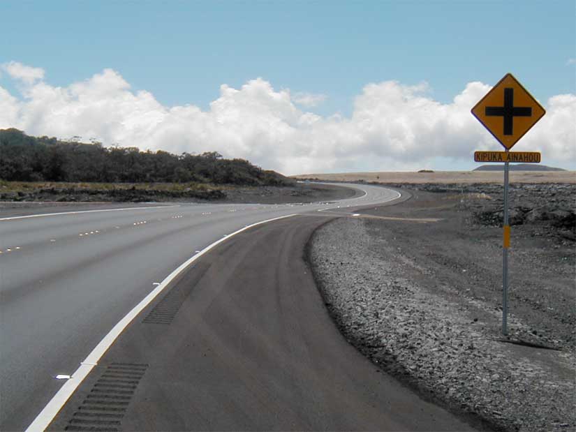
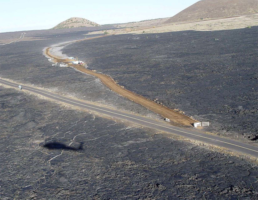
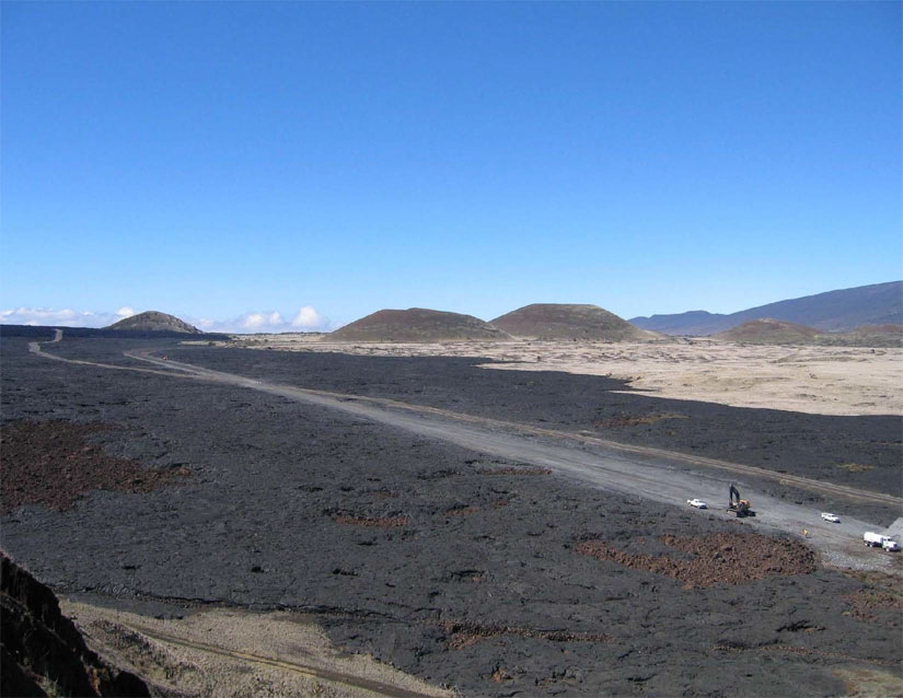
Saddle Road is the shortest route between East and West Hawai'i, especially between Hilo and the Kona Coast. Although Saddle Road is currently narrow, with steep grades and sharp curves, travel time is still as low or lower than for the other two routes. Total employment on the island has been expanding since 1980. The average annual employment growth rate for 1980 to 1994 was 5.1 percent on the west side compared to 1.8 percent on the east. Growth rates in job creation have been declining in East Hawai'i, while increasing in West Hawai'i. Income trends parallel those of job creation growth rates. More workers in East Hawai'i are seeking job opportunities in West Hawai'i. Roughly 1.1 million tourists visited the Island of Hawai'i in 1995, with approximately 33 percent visiting the east side of the island and 67 percent visiting the west. Because of the condition of Saddle Road, automobile rental agencies restrict or prohibit use of their vehicles on the road, discouraging some tourists from including cross-island trips in their itineraries. People first arrived in the Hawaiian archipelago probably sometime between A.D. 300 and 600. The earliest inhabitants, probably departing from the Marquesas Islands, brought pigs, dogs, fowl, and many of the cultivated plants important to their subsistence economy including coconut, breadfruit, and taro. The early society is presumed to have been structured around the Polynesian concept of hereditary chieftainship, where the difference between the commoner and chief was not nearly as great as it would become in later Hawai'i culture. Native Hawaiians relied on the environment for survival. They recognized and practiced respect for a hierarchy of life based on regeneration and protection of food sources. They prioritized the non-disturbance of seed producing forest areas to promote new growth. To the Native Hawaiians the older trees are primary; those who use these trees as residence or food source are secondary. For this reason, mamane forest and kipuka are regarded as having special value to native Hawaiians. The mountains or land, water, and sky were a necessary part of the life cycle. The most prominent, celebrated place of religious importance within the project corridor is Mauna Kea, a natural land feature. S.5.2 Physical Environment Hawai'i, the largest island of the Hawaiian Archipelago, covers an area of approximately 16,360 km2. The island was formed by the activity of five volcanoes. The proposed project is located along the southern flank of Mauna Kea Volcano. The Saddle, located between Mauna Kea and Mauna Loa volcanoes, was formed by lava flows from both volcanoes which coalesced and formed a broad upland apron. Mauna Kea has not erupted in historical time, and is considered dormant. Mauna Loa remains active and is responsible for recent lava flows visible from the road. Ground elevations along the study corridor range from 390 m above mean sea level, occurring in Section IV, to 2055 m, occurring in Section II. The elevational differences and the open vegetation through the Saddle provide panoramic views of distant vistas and interesting geologic features. Rolling hills, cone shaped pu'u (cinder cones), broad valleys, and mountains are examples of the diverse landforms found within the corridor. In Section I, the landscape consists of a predominantly pastoral setting with few built features. The section is characterized by a broad, open grassland used for grazing. The existing visual quality is moderately low to moderate. Section II traverses a relatively flat valley. Much of the landscape is dotted with pu'u. Other elements include the built features of the PTA, grasslands, and shrublands. The eastern end of this section enters lava flows with sparse emergent vegetation. The existing visual quality ranges from moderately low to moderately high. Section III enters a landscape in which the lava flows are older and vegetation is more pronounced. The roadway weaves through forests with an understory of ferns and shrubs and pasture lands. The existing visual quality is predominantly moderately high. In Section IV, single family residences are located along the existing alignment of Saddle Road, creating a more urban setting for Segment EX-4A. Segment E-3 departs from the existing alignment and traverses mature forest with a dense understory of ferns and shrubs as well as agricultural pastureland. The existing visual quality of Segment EX-4A ranges from moderately low to moderately high. The existing visual quality of E-3 is moderately high. The proposed roadway alignments are generally underlain by four types of geologic materials, including volcanic ash deposits, cinder sand deposits, 'a'a lava flows, and pahoehoe lava flows. Speleological resources, such as caves and lava tubes, occur within the project vicinity. Geologic hazards within the study corridor include low-lying areas with potential flooding hazard, steep slopes with the potential for instability and landslides, soft soils or wetlands, ground subsidence, and known faults that may traverse the proposed roadway segments. In addition, the entire island is considered a lava hazard zone. The eastern portion of the study corridor is at greater risk from lava inundation than the western portion. Average annual rainfall within the project corridor ranges from less than 500 millimeters (mm) in Sections I and II, to 5,000 mm or more per year in Sections III and IV. Fog is not uncommon in the morning and afternoon hours. Trade winds blow from the northeast. Water resources and drainage characteristics occurring along the length of the project are diverse because of variations in the amount of rainfall. Infiltration of surface waters into the substrate is high and serves to recharge the island's groundwater aquifers. There are no areas within the project vicinity designated as principal or sole source aquifers. Sheet flow of rainfall runoff is prevalent. The topography is pseudokarstic and no perennial rivers or streams occur in the project corridor, nor within the watersheds tributary to the Saddle Road culverts and bridges. The project area crosses several major intermittent drainages, many of which were formed by glacial activity and contain no waters of the U.S. No Wild and Scenic Rivers are located within the project corridor or its vicinity. The proposed project is located within an area regulated by the Hawai'i Coastal Zone Management (CZM) Program. The CZM program has established specific objectives and polices to protect and preserve recreational resources, historic resources, scenic and open space resources, coastal ecosystems, and economic uses, to minimize coastal hazards, and to manage development. The project area is not within a defined Special Management Area of the CZM program. While there are no State air quality monitoring sites on the Island of Hawai'i, data available from other sources indicate that ambient pollutant levels are well below the State and Federal standards. There are no designated non-attainment areas (places that do not meet the National Ambient Air Quality Standards) within the State of Hawai'i. S.5.3 Biological Resources Vegetation types dominated by both native and nonnative plants occur within the project area. Plant communities dominated by introduced or alien species are also referred to as nonnative vegetation types in this document. Plant communities dominated by plants which occur naturally in the Hawaiian Islands are referred to as native vegetation types. Examples of nonnative vegetation types include fountain grass/mixed shrubland, pasture land, and lowland wet grassland. Examples of native vegetation types include 'a'ali'i shrubland, mamane/naio forest, pioneer vegetation on recent lava flows, and montane wet forest. The majority of Section I is pasture land dominated by kikuyu grass and other nonnative range grasses. It has been used for grazing for some time. Lower elevations of Section I support fountain grass/mixed shrubland. Areas covered by native plant communities are rare. The few remnant pockets of native mixed shrubland occur on cinder cones and larger stony ridges and outcrops, areas inaccessible to cattle and other grazing animals. The vegetation within Section II is primarily native. Because the PTA has not been grazed and military development is restricted to certain areas, the majority of the PTA remains in native natural plant communities with a large proportion of the installation containing rare plants. Hard-stemmed lovegrass grassland, 'aweoweo shrubland, and 'a'ali'i shrubland are found on alluvial flats and the lower slopes of Mauna Kea on the western portion of this section. Mamane/naio forest occupies areas higher in elevation just north of the project area through the entire section and along the project corridor from the PTA cantonment area eastward past Mauna Kea State Park. At the eastern end of this section, nonnative pasture land vegetation is found on grazed lands. Section III is dominated by native vegetation types. It traverses a variety of micro-climatic zones and a number of vegetation types because past volcanic activity has created a mosaic of soils of different ages and character. Recent lava flows exhibit sparse pioneering vegetation. Kipuka, isolated pockets of late successional forest located on old lava flows, are interspersed through this section. Kipuka exhibit unique biological character, supporting the complex structure of the native Hawaiian rainforest, usually with an overstory canopy dominated by koa, a middle canopy layer dominated by 'ohi'a, and a lower canopy dominated by tree ferns. This habitat supports numerous species which are endemic (unique to the Hawaiian Archipelago) and is highly susceptible to invasion by alien species when disturbed. Section IV passes through highly modified habitat which is dominated by alien species. Fire poses a grave threat to some Hawaiian ecosystems by converting native habitats into grasslands dominated by nonnative species. Because few native Hawaiian animals or plants are adapted to wildfires, mortality during fires is high. Native shrubs and trees may recover from fire to some degree, but native plant communities are usually overwhelmed by more aggressive alien species. Many nonnative species, such as fountain grass, have a tendency to carry fire, are fire adapted, and thrive in the aftermath of fire. The establishment of this grass increases the threat of fire. Sections I and II traverse extremely dry habitat and are highly susceptible to fire. Because most of Section I has been highly modified and is now characterized by alien-dominated vegetation types, the impact of wildfires on native plants in this section is minimal. Within Section II, native-dominated vegetation types are prevalent. These vegetation types are extremely vulnerable to destruction by wildfire. Fire threatens the survival of rare-native animal species which rely on native habitats like the mamane/naio forest. Sections III and IV are not highly susceptible to fire because they are characterized by heavy rainfall. Wetland occurrence within the project corridor is limited to the area east of MP 14, within Sections III and IV. Within this area, three major native vegetation types occur: 'ohi'a forest, 'ohi'a scrub, and koa-'ohi'a forest. Because of local conditions, the presence of hydrophytic vegetation was considered the determining factor in locating regulatory wetlands. Under this method, wetlands were present on all of the 'ohi'a forest, approximately 15 percent of the 'ohi'a scrub, and less than 2 percent of the koa-'ohi'a forest. The list of native birds likely to occur within the project area includes 18 species, 9 of which are endemic and 3 of which are migratory. There are also 28 nonnative resident species. While the bird fauna throughout the project area is dominated by introduced species, Sections II and III support a relatively high diversity of native birds within mamane/naio forest and kipuka habitats. Hawai'i has only one native terrestrial mammal, the Hawaiian hoary bat, which is distributed throughout the project area. All other terrestrial mammals in Hawai'i were introduced by man and are considered alien species. The project area harbors a diverse native and nonnative invertebrate fauna, including 13 snail and hundreds of insect and arthropod species. The invertebrate populations found within Sections I, III, and IV are dominated by introduced species. Section II supports a variety of endemic insects, as well as the most diverse assemblage of snails found in the project area. Within Section III, a variety of endemic insects are associated with kipuka and cave habitats. Listed species refer to those species afforded legal protection as endangered, threatened, proposed endangered, and proposed threatened by the USFWS. Table S.5, Listed Species in the Vicinity of the Project Area, identifies listed species known or expected to occur within the project area. All listed species identified are endangered, with the exception of the Newell's Shearwater, which is threatened. Proposed endangered or threatened species are also addressed in this EIS. Critical Habitat has been established for the endangered Palila within Section II and occupies nearly all mamane/naio forest habitat identified for the project. Palila are highly dependent on mamane trees as a food source and for nesting. Fire has been identified as the single greatest threat to the continued survival of the Palila and other sensitive species which rely on the mamane/naio forest habitat. The northern boundary of the 'Ainahou Nene Sanctuary is adjacent to the existing Saddle Road for a length of 7.6 km in Section III.
S.5.4 Cultural Resources Prehistoric use of the project area includes cross-island travel, access to interior resources, birdcatching, agriculture, basalt gathering, and harvest of koa logs. Historic use of the project area includes ranching, hunting, cross-island travel, lumber milling, growing sugar cane, tourism, military strategy during World War II, and military training. Nineteen archaeological sites within the survey corridor are recommended for listing on the NRHP. These include Old Waimea-Kona Belt Road and a habitation/animal enclosure (Section I); Ka'ohe Wall, Humu'ula Sheep Station Perimeter Walls, Old Waimea-Humu'ula Wagon Road, and a post and wire fence (Section II); Pu'u 'O'o-Volcano Trail, Humu'ula Sheep Station Perimeter Walls, Hilo-Pu'u 'O'o Trail, Saddle Road, two linear lava wall sites, and a lava paving site (Section III); a surveyor's cairn, 'Ola'a Flume, Hilo Country Club, and Senator Kimi's House (Section IV). S.6 ENVIRONMENTAL CONSEQUENCES Table S.6, Summary of Impacts, summarizes the environmental consequences of the proposed actions assessed in the Saddle Road FEIS. The table outlines differences between each of the build and no action alternatives for major resource categories.
S.7 CUMULATIVE IMPACTS Cumulative impacts are the result of incremental impacts of an action when added to other past, present, and reasonably foreseeable future actions. Development within the Saddle Road area and on the island as a whole has resulted in the loss and degradation of resources unique to the island. The development within the Saddle Road corridor includes ranching operations, recreational facilities, public use areas, utility corridors, mining operations, military facilities, hunting units, scientific research, and residences. Current plans and potential projects under consideration in the project vicinity include the expansion of Mauna Kea Science Reserve, the extension of the runway at Bradshaw Army Airfield, the construction of an additional electric transmission line, the installation of a fiber optics transmission line, the extension of Puainako Street, and the development of an improved connection between Mamalahoa and Queen Ka'ahumanu Highways. An improved roadway would increase the pressures of growth and development in areas served by Saddle Road. This would contribute to traffic along Saddle Road and use of the area by residents and tourists. Increased traffic and increased use of the area regardless of road improvements are expected to result in further introduction and spread of alien species, heightened risk of fire, and associated impacts on native ecosystems and species. Development and land use conversion across the island have created a trend toward the destruction of cultural resources, reduction in visual quality, soil erosion, water quality degradation, the destruction of caves, and the alteration of topographical features. All build alternatives, and to a lesser extent the No Action Alternative, would contribute to this trend. S.8 PROPOSED MITIGATION COMMITMENTS Mitigation measures have been developed in order to minimize both short-term and long-term impacts of the proposed project. Mitigation commitments for impacts to the human environment are to maintain free-flowing access to existing land uses, provide scenic pullouts and parking, facilitate emergency access, minimize traffic conflicts, and keep the public informed of anticipated delays. FHWA will develop relocation assistance and benefits for any residents displaced by the project. Hazardous materials and unexploded ordnance will be handled to ensure proper treatment of these materials. Native Hawaiians will be employed to observe cultural ritual protocol at the construction site. Mitigation commitments for construction impacts to the physical environment are to implement dust and equipment emission control measures. Prior to construction, FHWA will coordinate with speleological experts to reduce the risk of impacting caves or lava tubes. Construction techniques that create natural-appearing roadside surfaces and roadway appurtenances will be utilized to minimize the visual impact of the project at the location of cut and fill slopes. Remnant landforms will be removed at select locations. General mitigation commitments for impacts to biological resources are to limit surface disturbance to within the ROW, ensure proper environmental awareness of construction workers, revegetate appropriate locations, prohibit night-time construction lighting, and adopt construction practices that minimize dispersion of alien species. An alien plant species monitoring and control program will be implemented. During final design, the alignment will be shifted to avoid kipuka. Sensitive habitats like kipuka will be fenced during construction along the right-of-way (ROW). A fire ecologist will be contracted to create a fire model(s) and develop a comprehensive fire management plan. Paved fire breaks will be constructed in areas of critical fire concern, and emergency call boxes will be provided along the route in fire prone areas. To offset unavoidable impacts of the project to wetland and aquatic areas disturbed by the roadway footprint, mitigation commitments will incorporate restoration efforts to restore and preserve habitat within all portions of the ROW not essential to the operation and maintenance of the roadway. Restoration efforts may also include the acquisition or preservation of lands beyond those needed for ROW. A search for Hawaiian Hawk nests will be conducted within Sections III and IV prior to construction. Commitments have been made to undertake significant mitigative steps to offset potential impacts on federally-designated Critical Habitat for the endangered Palila. A Palila Mitigation Plan has been prepared and an associated Memorandum of Understanding (MOU) has been developed and signed by participatory agencies. Mitigation includes the acquisition and management of areas for habitat restoration and Palila translocation (FEIS - Part I, 3.18.3). Mitigation commitments for impacts to 19 archaeological sites eligible for the NRHP include avoidance through the shifting of the alignment, data recovery efforts, the installation of interpretive signs and pullouts to enhance public awareness, and periodic monitoring during construction. These commitments have been agreed upon by the Advisory Council on Historic Preservation (ACHP), State Historic Preservation Office (SHPO), HDOT, FHWA, and Office of Hawaiian Affairs (OHA) and documented in an executed Memorandum of Agreement (MOA). S.9 PROJECT DEVELOPMENT HISTORY OF THE SADDLE ROAD PROJECT The following list summarizes the history of the Saddle Road EIS project and provides notable milestones to the coordination and public involvement process. Initially, improvements for Saddle Road had been considered only along the existing alignment within the boundaries of the PTA. The summary provided begins with the decision to expand the project planning to include the roadway sections outside of the PTA boundary. 2/91 Interagency scoping meeting held in Honolulu to discuss various agency needs and concerns for improvements along existing alignment within PTA. PTA realignment recommendation presented by U.S. Army representatives. Full EIS anticipated for realignment. Consensus achieved between most agency representatives, with some reservations, that realignment would improve public safety. 4/91 Request made by MTMC that development efforts along the existing alignment be stopped and efforts be redirected to develop the realignment proposal. 5/91 New estimate and schedule submitted by FHWA for realignment construction between MP 30 and 43. Cost estimated at $11.3 million. New surveys, mapping, location studies, and environmental compliance expected to delay initial construction project. Because HDOT was not agree with realignment proposal, work stopped by FHWA until agreement between participating agencies could be reached. 6/91 Support for realignment proposal forwarded by Senator Daniel Inouye and HDOT. 11/91 SEE Team reconvened to advance project development considering realignment proposal. Need determined for full EIS for entire Saddle Road from MP 5 to MP 53 to comply with logical termini requirement. 2/92 Estimate prepared by FHWA to complete project development, including environmental compliance from MP 5 to MP 53. Cost estimated at $2.3 million. Interagency meeting held in Honolulu and public scoping meetings held in Hilo, Waimea, and Captain Cook. FHWA work suspended pending MTMC consideration of additional project development requirements. 4/92 HDOT participation in additional project development funding requested by MTMC. 2/93 $2.34 million in DAR funds for project development authorized by MTMC. 3/93 Project development activities resumed. Aerial survey and mapping process for realignment studies initiated. 5/93 Citizens of the County of Hawai'i invited to form a task force by Senator Inouye to solicit and disseminate information about the project within the community and work with the project development team. 6/93 SEE Team reconvened for meeting in Honolulu. First citizens task force meeting held (SRTF). 8/93 Mission Statement adopted and goals identified by SRTF. 1/94 RUST Environment and Infrastructure selected by FHWA, under an umbrella contract to perform environmental compliance and preliminary route location design studies. Okahara & Associates (O & A) selected by RUST for all local project coordination efforts in Hawai'i. Meeting held between FHWA, RUST, O & A, SRTF, and various agencies to establish communications and develop schedule for project development and scoping process. 3/94 Letter of Intent sent to all interested parties, agencies, and organizations and Notice of Intent published in Federal Register. 4/94 Notification of Public Scoping Meetings mailed to all interested parties, agencies, and organizations. 5/94 Public Scoping Meetings held in Hilo, Kona, and Waimea. Interagency Scoping Meeting held in Hilo. SRTF scoping meeting held in Waimea and SEE Team scoping meeting held in Hilo. Traffic Study completed by RUST. Traffic volumes on Saddle Road determined to be 900 ADT in 1994 and forecasted to be 14,000 ADT in 2014 with proposed improvements. 6/94 Several SRTF Meetings held to generate input on project purpose and need. 7/94 Saddle Road Project Information Centers opened in Hilo and Kona to make project information available to interested persons and to receive comments. Notices of information centers published in Hilo and Kona newspapers. 8/94 SRTF Meeting held to brief members on project development progress and review proposed alignments developed through scoping process. Field trip to view alternative alignments conducted. Recommended alternatives developed by SRTF to present to SEE Team for further consideration. 10/94 SEE Team meeting held in Hilo to brief team on scoping results, review project objectives and purpose, and select alternative alignments for further engineering and environmental study (102 miles of alternatives selected). 11/94 SRTF meeting held to review project alternatives advanced for further consideration and project issues and concerns identified. First Saddle Road Newsletter published and sent to mailing list (approximately 800 distributed). 2/95 Second project development contract initiated with RUST for surveying, mapping, preliminary route location design, and environmental field studies and reports on alternatives developed through scoping process. RUST project team selected, consisting of 12 subconsultants; 10 locally based in Hawai'i. 3/95 SRTF Meeting held to brief members on status of project development tasks recently initiated and receive input on progress, issues, and concerns. Meetings held with State of Hawai'i Department of Land and Natural Resources (DLNR) to coordinate rights-of-entry for surveying and environmental inventories; review procedures of environmental studies for consistency with Conservation District regulations. Through October of 1995, field work conducted by subconsultants, including biological, botanical, avian, and archaeological surveys and interviews of tourists, road users, truckers, and other citizens conducted. 4/95 Interagency meeting held to brief agencies on project status and schedule for environmental field inventories and engineering studies. New construction cost estimates prepared: PTA section $35 million, remainder of Saddle Road $68 million. 8/95 Coordination meeting held with DOA at PTA to discuss issues and concerns relative to alternative alignment studies to date. 10/95 Field review of potential alternative alignments and available mapping for west side held with RUST and O & A. Critical Interagency meetings held with DOA and USFWS, DLNR, and NBS to discuss findings of preliminary route location alternatives and potential environmental effects and to receive comments on resulting issues and concerns. Funds made available to begin work on environmental studies portion of RUST contract. Environmental Assessment and Notice of Preparation of EIS submitted to Office of Environmental Quality Control. 11/95 SRTF, SEE Team and Interagency meetings held to review preliminary alternatives route location and design and receive input. Line and grade field review of first half of staked preliminary alignments held with HDOT, RUST, FHWA, and other interested agencies. Comments incorporated in revisions. 12/95 SRTF meeting held to review project progress and future project development procedures and schedule. 2/96 Line and grade field review of second half of staked preliminary alignments held with RUST and O & A. Team planning concept initiated for project development. Environmental Project Manager and Local Coordination Manager appointed. 3/96 Discussions with U.S. Army Corps of Engineers (USACE) held to perform remaining archaeological inventories and studies within the PTA. 4/96 SRTF and SEE Team meetings held. SRTF briefing on project status held at PTA with Senator Inouye and DOA representatives. SEE Team meeting held to review progress status and issues and concerns on various project alternatives. Decision made by SEE Team to eliminate alternatives W-4 and E-1 from further detailed consideration; concurrence obtained from SRTF. Several meetings held between FHWA staff and National Biological Service (NBS), USFWS, and USACE to discuss Palila critical habitat (field trip and mitigation discussions), invertebrate inventories, archaeological studies in PTA, and wetlands considerations. Informal consultation initiated with USFWS on critical habitat impact mitigation for Section 7 Consultation. 5/96 Preliminary route location design plans completed and exhibits submitted to environmental subconsultants for study reports. Preliminary Design Study Report completed. Sixteen invitations for Cooperating Agency status sent; three acceptances received. Meetings held between FHWA staff and U.S. Army Garrison-Hawai'i (USAG-HI), USFWS, Division of Forestry and Wildlife (Hawai'i), HDOT, and National Biological Service (NBS) to discuss coordination of DOA's Ecosystem Management Plan (EMP) with Palila mitigation effort and general elements of a Palila Mitigation Plan as proposed by NBS. First draft of a specific mitigation proposal with cost estimates presented by NBS. 6/96 Workshop given by FHWA, Hawai'i Division, to subconsultant team on EIS Preparation. New construction cost estimates submitted based on preliminary design received from consultants: PTA, $34 million to $40 million; remainder of Saddle Road, $92 million to $106 million. Cost dependent on alternative selected. 7/96 Modification made to RUST contract to provide for biological survey and report on invertebrate species as required by USFWS, research to assess social effects of alternatives relative to Native Hawaiian culture, and extend the authority of existing subconsultant to provide archaeological and historical properties investigations within PTA in lieu of USACE. State participation in funding of Saddle Road project development effort committed by HDOT. 8/96 Meetings held between FHWA staff and USAG-HI regarding coordination of their EMP efforts with Saddle Road mitigation proposals. Discussions held with new subconsultant to develop Public Information Program (newsletters followed). Additional cultural properties field inventories initiated within PTA. 9/96 Meeting held with subconsultant to initiate compilation of Biological Assessment (BA) as required for Section 7 consultation of Endangered Species Act. 10/96 SRTF, Interagency, and SEE Team project development meetings held in Hilo to review project alternatives and associated affected environments, impacts, and proposed mitigation, and solicit input relative to issues, and concerns. Proposed project schedule and interagency coordination discussed. Selection of possible preferred alternatives discussed by SEE Team. Alternatives EX-4 and EX-1 eliminated. 11/96 Interagency meeting held in Honolulu, hosted by Senator Inouye, to discuss specific project mitigation elements, processes, and coordination required including critical habitat replacement land transfers, management strategies, funding, and necessary agreements. Elements and procedure for BA to be required by USFWS for this project confirmed. Fire prevention roadway cross-section confirmed. Discussions held on coordination of DOA's EMP with Palila Mitigation Plan. Discussions held with HDOT on project development issues impacting scope of possible initial construction project. Field trip conducted with FHWA, USFWS, and USACE to review wetland findings and discuss procedures for jurisdictional delineation and permitting requirements. Issue #2 of Saddle Road Newsletter distributed to approximately 1,170 groups and individuals. 12/96 SRTF meeting held to present results of discussions and interagency coordination to date and receive community-related input from members on all project issues and concerns as well as public information program progress and plans. FHWA solicitation opened for new contract for Hawai'i-based firm; first task order to include continued work on environmental studies and preliminary design. 1/97 Issue #3 of Saddle Road Newsletter mailed to approximately 1,170 groups and individuals. 3/97 Preliminary Draft EIS (PDEIS) distributed to all participating, cooperating, and coordinating agencies for review and comment. PDEIS distributed to internal staff for review. BA submitted with request for early coordination under Section 7 to USFWS. Need determined for additional funding to complete further environmental compliance studies. Technical report on archaeological and historical properties received at FHWA. 4/97 Two Interagency meetings held to discuss issues, impacts, and mitigation proposed as presented in the PDEIS. Most agency written comments received by end of month as requested. Confirmation from USFWS received that all details of multi-agency management of Palila mitigation lands would need to be resolved before submittal of BA. Letter sent transmitting cultural properties report to SHPO and requesting concurrence with eligibility determinations. O & A selected for work in Hawai'i under Indefinite Delivery/Indefinite Quantity Contract. O & A's first task order provides for continuance of environmental and design work on project. 5/97 Procedures and methodology for DOA 404 permitting and jurisdictional determinations requested from USACE. Verification of Nene Sanctuary status requested from DLNR. 6/97 Draft summary of Palila mitigation lands multi-agency management strategies tentatively agreed upon by coordinating agencies in a series of meetings in May and June sent to agencies for comment. Meeting of various individuals and hunting organizations held to identify issues related to potential impacts on hunting resources and activities. 7/97 Task order executed with O & A to proceed with additional environmental compliance work and location and design refinements for environmental mitigation under ID/IQ contract. Response from USACE on 404 permitting and delineation requirements received. Meetings held with various hunting organizations and individuals to identify issues related to potential impacts on hunting resources and activities. 8/97 Meeting of FHWA, O & A, and subconsultants held to determine new schedule and required coordination for remaining work through publication of DEIS, public hearings, and close of public comment period. Response letter received from SHPO regarding eligibility concurrence. Jurisdictional determination requested and received from USACE 10/97 DEIS published and distributed to mailing list. BA submitted to USFWS with request for initiation of Section 7 Formal Consultation. 11/97 Notice of Availability of DEIS published in Federal Register and Hawai'i Office of Environmental Quality Control Bulletin. Public Hearing notices published and letter advising of availability of DEIS and Public Hearing locations and dates sent to project mailing list. Notice received from SHPO stating that further ethnographic studies would be required to determine eligibility of mamane forest and Mauna Kea as Traditional Cultural Properties. 12/97 Two Public Hearings held: one held on weekday on west side of Island of Hawai'i and one held on Saturday on east side of Island of Hawai'i. Public comment period ended. USFWS letter received stating that BA was adequate and a Final BO would be delivered by March 27, 1998. 1/98 DEIS comments received through this month. EPA comment letter received and discussions with EPA, USACE, State of Hawai'i DLNR and SHPD began to resolve outstanding issues. 2/98 To allow more time to resolve endangered plant issues, FHWA and USFWS mutually agree to extend the date for the Final BO to April 17 and that it would be submitted in draft form until Palila mitigation implementation details could be confirmed. DEIS comments received from DOI; began resolution of outstanding issues with USFWS. 3/98 SEE Team reviews all information and agency coordination received to date and comparative analysis of alternatives and recommends selection of W-3, PTA-l, EX-3, and E-3 as Recommended Alternative. Work begins on 404(b)(1) analysis to address issues raised by the EPA and USACE with regard to alternative alignments in wetland area and proposed mitigation. 4/98 USFWS issues Final BO in which it is concluded that "the mitigation measures built into the project...will offset the modifications being made to palila critical habitat and enhance the likelihood of survival and recovery of the palila." Revised archaeological inventory and historic assessment report submitted to SHPO requesting concurrence with eligibility determinations, effects, and proposed mitigation. 5/98 404(b)(1) Analysis Report submitted to the HDOT, USACE, EPA, USFWS with request for concurrence on the selected alternative and mitigation measures proposed. 6/98 Letters of concurrence from USFWS, HDOT, and USACE on 404(b)(1) Report received. EPA indicates verbally that they do not agree with suppositions, analyses, alternative selection, and mitigation as proposed in 404(b)(1) Report and that a memorandum outlining the basis for disagreement will follow. 8/98 Letter from EPA received in disagreement with selection of Least Environmentally Damaging Practicable Alternative (LEDPA) in Section IV as well as mitigation proposed. 9/98 Reply to EPA August letter sent, meeting with EPA to resolve issues of disagreement, additional costs of non-selected alternative and mitigation requirements agreed upon. 10/98 Letter sent to EPA outlining modifications to LEDPA costs and mitigation and identifying the basis for agreement. Agreement reached with SHPD on eligible sites, effects, and mitigation proposed; MOA finalized with SHPD and consultation begins with OHA on MOA. 11/98 Preliminary FEIS distributed to all agencies for final review and comment. 12/98 Letter received from EPA documenting agreed upon LEDPA alternatives, wetlands mitigation, and 404 Permit process to be followed for programmed projects. Revised Draft MOA transmitted to OHA and signatory parties. 1/99 Meetings held with agencies to discuss preliminary FEIS, resolve any remaining concerns. Initiate consultation with DHHL on Section 106 MOA. All signatory parties to MOA reach agreement; concurring party OHA indicates disagreement on wording in MOA with respect to their role and sites. 2/99 Meeting held with DLNR to brief new director and reinforce coordination efforts required in Palila mitigation and MOA finalization. Problems develop with BRD budgeting of partial Palila mitigation. 3/99 Clarification of significance criteria for archaeological sites received from SHPO. Staff meeting with OHA to discuss further concerns on MOA. 4/99 Meeting with OHA Land Committee to request recommendations of approval of MOA to Trustees; OHA Trustees approve MOA. All issues resolved and FEIS revised for publication. "Reasonable assurance" of Palila mitigation funding secured from DOD. 7/99 Meetings with DLNR and ranchers to review Uniform Relocation Assistance and Real Property Acquisition Policy Act and initiate transferral of Palila mitigation lands. Final SRTF meeting held. 8/99 FEIS published and Conservation District Use Application (CDUA) submitted. Final project newsletter distributed to mailing list. Numerous meetings were held between January, 1994, and the present with interested individuals, agency representatives, and public and private organizations to provide project briefings and receive input on project issues and concerns. A list of organizations for which one or more formal project briefings were presented at various stages of the project is presented in Table S.7, Community Organizations.
Open community meetings were held in Hilo, Kona, and Waimea from April through October, 1995, to present project briefings and distribute social impact survey questionnaires. S.10 CONSISTENCY OF ALTERNATIVES WITH EXISTING PLANS AND POLICIES The proposed Saddle Road project complies with appropriate State and County land use policies, plans, goals, objectives and controls. It would facilitate implementation of the State Plan, the Transportation Function Plan, the Island of Hawai'i Long Range Highway Plan, the County of Hawai'i General Plan, and the land use controls and regulations as established pursuant to the State Land Use Law and the Hawai'i County Zoning Code. Table S8, Conformance with Land Use Plans and Policies, summarizes the project's conformance with previously described land use plans and policies.
Mgt. = Management, Trans. = Transportation, Com. = Community, D.V.. = Development S.11 REQUIRED PERMITS AND APPROVALS A number of permits or other approvals may be necessary prior to implementation of the Recommended Alternative. The following list (Table S9, Permits and Approvals) represents those permits or approvals identified to date. Additional permits might be identified subsequently if project modifications, mitigation measures, or refinements in final design warrant.
S.12 RESOLVED ISSUES Several issues emerged during circulation of the DEIS that required further coordination with regulatory agencies; however, all have been resolved to the satisfaction of the agencies involved. There were no unresolved issues at the time of publication of this Final EIS. These formally-unresolved issues and their resolution are as follows.
|
|||||||||||||||||||||||||||||||||||||||||||||||||||||||||||||||||||||||||||||||||||||||||||||||||||||||||||||||||||||||||||||||||||||||||||||||||||||||||||||||||||||||||||||||||||||||||||||||||||||||||||||||||||||||||||||||||||||||||||||||||||||||||||||||||||||||||||||||||||||||||||||||||||||||||||||||||||||||||||||||||||||||||||||||||||||||||||||||||||||||||||||||||||||||||||||||||||||||||||||||||||||||||||||||||||||||||||||||||||||||||||||||||||||||||||||||||||||||||||||||||||||||||||||||||||||||||||||||||||||||||||||||||||||||||||
|
|
||||||||||||||||||||||||||||||||||||||||||||||||||||||||||||||||||||||||||||||||||||||||||||||||||||||||||||||||||||||||||||||||||||||||||||||||||||||||||||||||||||||||||||||||||||||||||||||||||||||||||||||||||||||||||||||||||||||||||||||||||||||||||||||||||||||||||||||||||||||||||||||||||||||||||||||||||||||||||||||||||||||||||||||||||||||||||||||||||||||||||||||||||||||||||||||||||||||||||||||||||||||||||||||||||||||||||||||||||||||||||||||||||||||||||||||||||||||||||||||||||||||||||||||||||||||||||||||||||||||||||||||||||||||||||||
|
|
||||||||||||||||||||||||||||||||||||||||||||||||||||||||||||||||||||||||||||||||||||||||||||||||||||||||||||||||||||||||||||||||||||||||||||||||||||||||||||||||||||||||||||||||||||||||||||||||||||||||||||||||||||||||||||||||||||||||||||||||||||||||||||||||||||||||||||||||||||||||||||||||||||||||||||||||||||||||||||||||||||||||||||||||||||||||||||||||||||||||||||||||||||||||||||||||||||||||||||||||||||||||||||||||||||||||||||||||||||||||||||||||||||||||||||||||||||||||||||||||||||||||||||||||||||||||||||||||||||||||||||||||||||||||||||
|
Home | Newsletters | Maps | Exec.
Summary | Hunting |
|
|||||||||||||||||||||||||||||||||||||||||||||||||||||||||||||||||||||||||||||||||||||||||||||||||||||||||||||||||||||||||||||||||||||||||||||||||||||||||||||||||||||||||||||||||||||||||||||||||||||||||||||||||||||||||||||||||||||||||||||||||||||||||||||||||||||||||||||||||||||||||||||||||||||||||||||||||||||||||||||||||||||||||||||||||||||||||||||||||||||||||||||||||||||||||||||||||||||||||||||||||||||||||||||||||||||||||||||||||||||||||||||||||||||||||||||||||||||||||||||||||||||||||||||||||||||||||||||||||||||||||||||||||||||||||||